Trial multi layer map
All details in a single map, limited to Cornwall. The map is open to everyone.
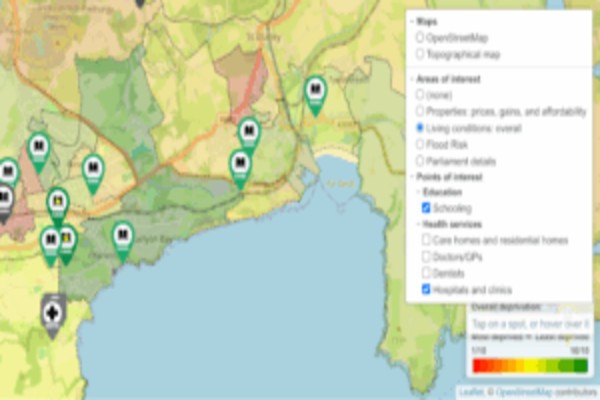
Multi layer member map
Property prices, affordability, price rises.
A limited set of data is open to everyone. The detailed data is for members only.
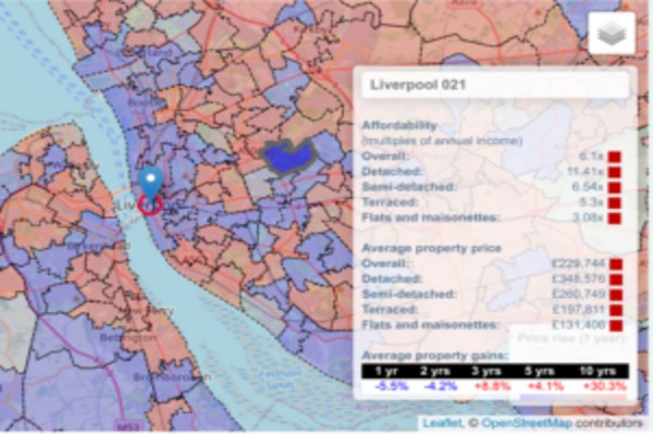
Property prices
All details in a single map.
Available for full members.
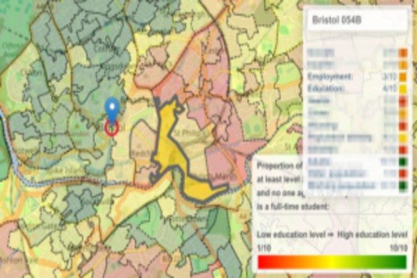
Living conditions
Overall living conditions, income, employment, education, health, crime levels, housing and and population density.
A limited set of data is open to everyone. The detailed data is for members only.
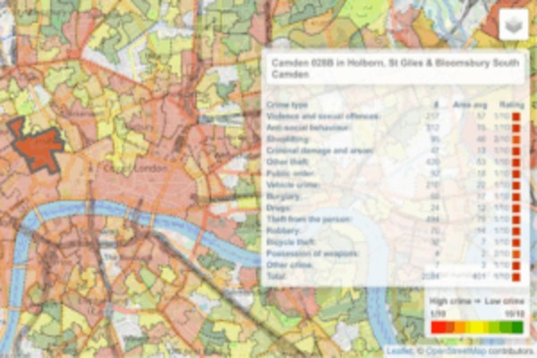
Crime
Statistics on all crime types.
A limited set of data is open to everyone. The detailed data is for members only.
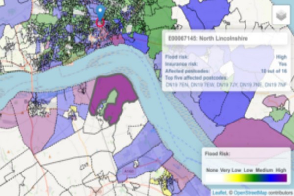
Flood Risk
Flood risk for an area, and property insurance risks. Available for full members.
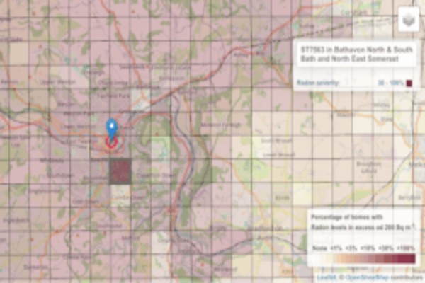
Radon gas levels
Statistics on exposure to Radon gas.
Available for full members.
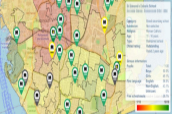
Schooling
Detailed school data with Ofsted rating.
Available for full members.
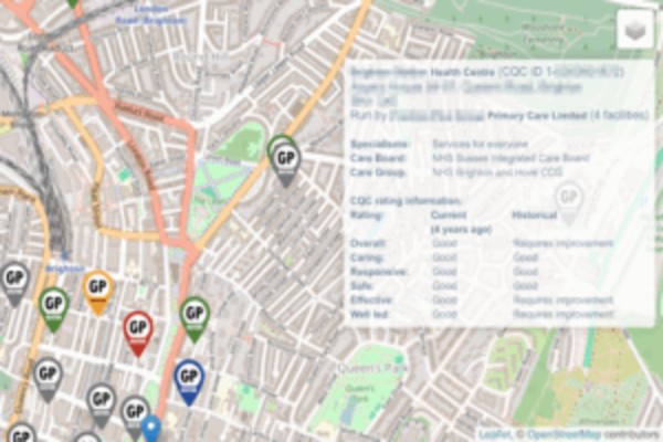
Doctors surgeries
Detailed data for local doctors surgeries with CQC ratings. Available for full members.
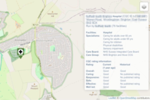
Hospitals
Detailed data for local hospitals with CQC ratings. Available for full members.
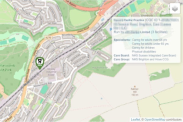
Dentists
Detailed data for local dentist surgeries with CQC ratings. Available for full members.
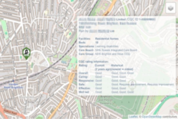
Care homes and nursing homes
Detailed data for local care homes and nursing homes with CQC ratings.
Available for full members.
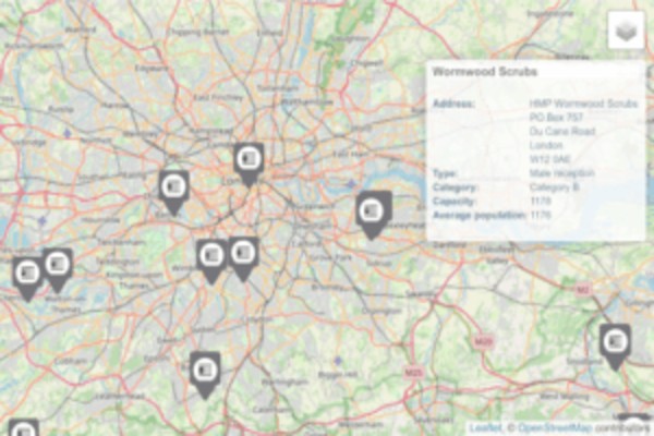
Prisons
All prisons in England. Available for full members.
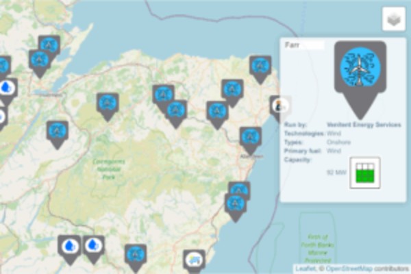
Power stations
All power stations in the UK: Solar farms, oil, gas, wind farms, nuclear, hydro, …Available for full members.
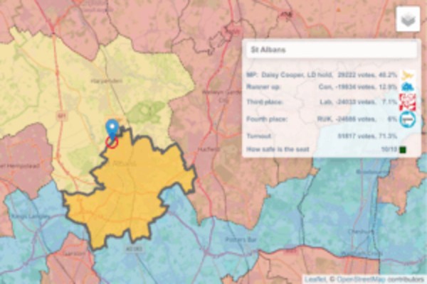
Parliament details
Election results: MPs, parties, runner ups, majority, turnout. The map is open to everyone.